CCC Naval Point Sub Lyttelton
Due 28.7 https://www.ccc.govt.nz/the-council/consultations-and-submissions/haveyoursay/show/248
Submission from Spokes Canterbury
Rate payers need some indication of the eventual total cost. How much more than $10.65 million will be required? We are offered 2 options with no indication of what the final overall costs might be. It is understood that there are many variables and difficult to predict costs. What are the big expenses? What is the cost of either 270 or 400 car and boat parks? If significant; what other options might there be? What might the land costs for option 2 be? Buildings are to be replaced; who will pay? Without providing such basic information Council irresponsibly raises ratepayer’s expectations. Is this a consultation or a sales presentation?
Options Offered
Option 1:
Thank you for providing pedestrian connections along Godley Quay and Charlotte Jane Quay, as well as along the waterfront and to key site activities. Not indicated is what is on offer or if there is pedestrian infrastructure to get from Lyttleton to the project area. Will the access referred to in Option 2 be a part of this?
Sadly both cycle parking and cycle access are missing from this option. Yet 270 car and boat parks are promised.
Option 2:
Elements include:
“a circular access route off Charlotte Jane Quay, allowing for better access to and through the site creating pedestrian connections along Godley Quay and the rail corridor, as well as along the waterfront and to key site activities”. There is also access for “pedestrian circulation” shown, but no provision for the safe circulation of people on bicycles.
Not indicated is what infrastructure is on offer or if there is pedestrian and cycle infrastructure to get from Lyttleton to the project area. But, the sporting grounds are to be reoriented to increase parking for up to 400 car and boat parks. The priorities here are very clear and stuck in the past.
Furthermore, as the use of vehicles fueled by petroleum products is certain to reduce in future, it is very likely that the type of facilities people need to launch boats will change in the future, and it is far more likely that boats will be stored on site and launched using automatic or shared equipment. Consequently, any infrastructure used for parking of 400 boats and trailers should be able to be easily transformed in anticipation of these changes.
Finally under advantages for Option 2 is this: “Better connectivity for pedestrians and vehicles to and from the site.”
No detail on what the pedestrian and cycle infrastructure will be is offered.
And this
“Addition of an emergency access route along the rail corridor, which will also be used as a pedestrian and cycle route.”
Not a promise of cycle infrastructure, but a vague pedestrian and cycle route without clear indication of what is on offer, where it comes from or what it hooks up to. The option 2 map merely indicates a pedestrian link coming from somewhere off the map. Assuming it will cut through port land to Godley Quay just east of the tank farm what pedestrian and cycle infrastructure will be provided in the project area and on Godley Quay? What connections will be provided to Lyttelton? How will this project support making multi modal transport options at least as attractive as driving?
On the plan it is also shown there is a proposed pedestrian link to Godley Head via LPC land, currently occupied by the disused rail lines. Spokes fully supports this link, and considers this link should also be available by people cycling. To do this however, it would be ideal if a walking and cycling link could be made from Naval Point to the pathway alongside Te Ana marina, and continue (at a similar gradient) below Simeon Quay to emerge on the road below the Sutton Reserve. Spokes has heard that this issue and the associated moving of the port gate has been discussed with LPC, but that at present the timeframe discussed for this is 10 years, which in our view is far too long.
Comments applicable to both options
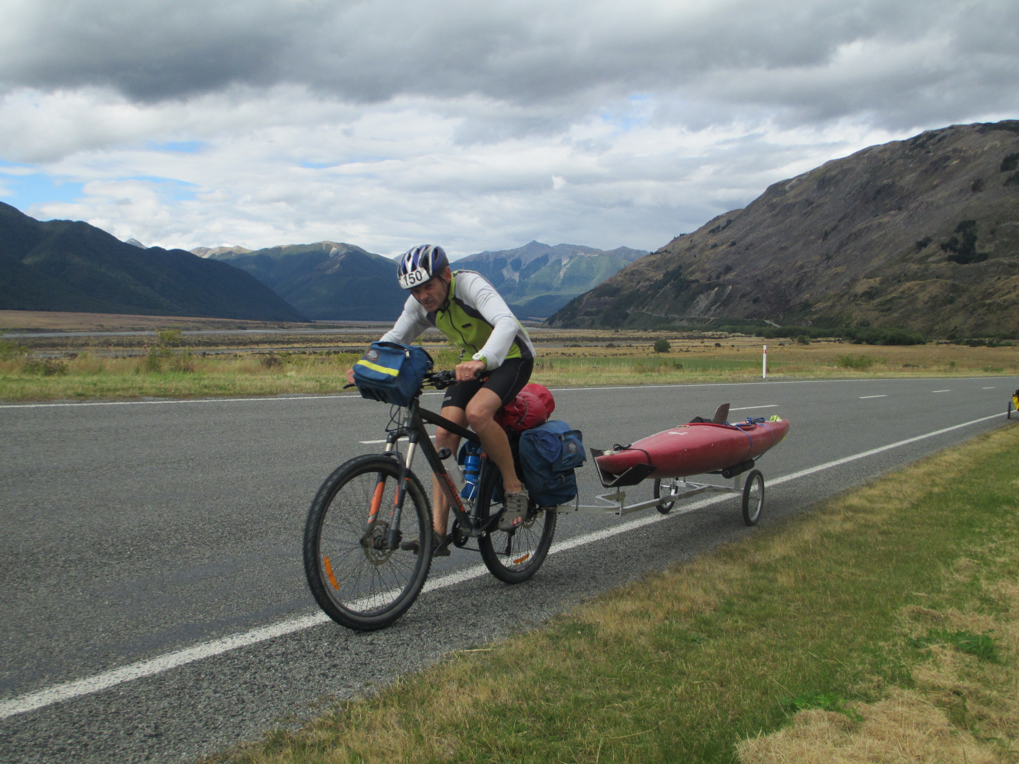
The public hand launching and wind surfing ramps will need to include well located, adequate, expandable and secure cycle parking in close proximity which allows for bike and bike trailer parking. People on bikes do carry small water craft and sail boards, and this is likely to become more common with greater use of e-bikes. See photo.
Sports fields, future youth and activity areas need well located, adequate, expandable and secure cycle parking in close proximity. Cycle parking is also necessary near Magazine Bay where many teenagers and others come to swim and to the Learn to Sail and Windsurf facilities.
Where is the planning for access via public transport? Where is even a mention that the needs of the disabled have been considered? As offered people will drive, create congestion and increase emissions.
Those who do not drive will need to be driven.
Perhaps information on provisions for active and public transport will be provided in later consultations? Not good enough. We are offered assurances of car and boat parking, minimal information on pedestrian and cycle access, and nothing on public transport and disabled access. This consultation document effectively promotes business as usual transport, which given the rapid rate of change is very short-sighted.
Closing Comments
This consultation lacks basic information seriously hobbling informed public comment. Spokes has often pointed out the need for complete information and asked that it be provided, publicly, to all, as part of the process. It is beyond disappointing that Council’s consultation process remains grossly deficient. Is this even legal?
The project is laudable; that it remains ensconced in a business as usual car centric bubble is not. Council’s declaration of a Climate Crisis needs to be applied in all projects. The level of neglect, oversight, incompetence or unconscious promotion of single occupancy vehicles in these plans is simply not acceptable. The need for an empowered cycle advisory panel to sign off on projects prior to consultation is clearly required.
As presented neither Spokes nor anyone else can offer an informed choice on either option, it is dismaying that this worthy project has gone so far while offering so little. Neither option is supported.